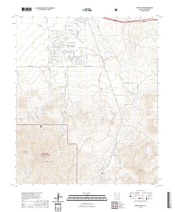
2021 Map of Mount Fagan
USGS Topo · Published 2021About this map
New Tucson occupies the northern portion of this landscape, characterized by a structured grid of residential streets like E Andrada Rd and E Sahaurita Rd. This developing residential area stands in contrast to the high desert terrain to the south, where the Coronado National Forest protects the peaks of the Santa Rita Mountains. Dominating the central topography is Mt Fagan, surrounded by a network of drainage features including Papago Canyon and Mulberry Canyon. The importance of water management in this arid environment is evident in the numerous named tanks and springs, such as Missile Tank, Cemetery Tank, and Davidson Spring. The Arizona National Scenic Trl winds through the canyons, providing a recreational corridor through the transitional space between the foothills of the Empire Mountains and the expanding reach of modern settlement.
Find a feature on this map
54 named features on this map. Tap any name to fly to it.
Don’t see what you’re looking for? This feature index may not catch every label — zoom into the map to look around manually.
Map Details
Editions of this 2021 Mount Fagan Map
This is the sole edition of this map. No revisions or reprints were ever made.
Other maps of this area

1904 · Patagonia
USGS Topo · 1:125,000

1904 · Tucson
USGS Topo · 1:125,000

1905 · Patagonia
USGS Topo · 1:125,000

1905 · Tucson
USGS Topo · 1:125,000

1926 · Helvetia
USGS Topo · 1:62,500

1948 · Tucson
USGS Topo · 1:62,500

1956 · Nogales
USGS Topo · 1:250,000

1956 · Tucson
USGS Topo · 1:250,000

1957 · Tucson
USGS Topo · 1:62,500

1957 · Rincon Valley
USGS Topo · 1:62,500