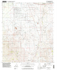
1996 Map of Mount Fagan
USGS Topo · Published 2002About this map
The Santa Rita Mountains and the Empire Mountains converge here at the high desert terrain of southern Arizona. Dominated by the peak of Mount Fagan, the landscape is defined by its deep mining history and complex water management. Evidence of the region's mineral wealth is scattered across the slopes, from the southern Helvetia Mines to the Cuprite Mine and California Mine further north. These industrial sites are interspersed with a network of cattle tanks such as Duck Tank and Missile Tank, essential for survival in this arid environment.
Find a feature on this map
49 named features on this map. Tap any name to fly to it.
Don’t see what you’re looking for? This feature index may not catch every label — zoom into the map to look around manually.
Map Details
Editions of this 1996 Mount Fagan Map
This is the sole edition of this map. No revisions or reprints were ever made.
Other maps of this area

1904 · Patagonia
USGS Topo · 1:125,000

1904 · Tucson
USGS Topo · 1:125,000

1905 · Patagonia
USGS Topo · 1:125,000

1905 · Tucson
USGS Topo · 1:125,000

1926 · Helvetia
USGS Topo · 1:62,500

1948 · Tucson
USGS Topo · 1:62,500

1956 · Nogales
USGS Topo · 1:250,000

1956 · Tucson
USGS Topo · 1:250,000

1957 · Tucson
USGS Topo · 1:62,500

1957 · Rincon Valley
USGS Topo · 1:62,500