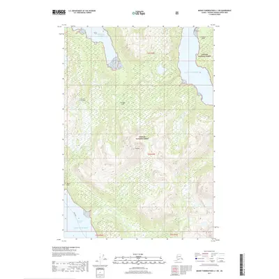
2017 Map of Mount Fairweather A-1 SW
USGS Topo · Published 2017About this map
Chichagof Island dominates this portion of Southeast Alaska, characterized by the dense timber of the Tongass National Forest. The coastal environment is defined by the deep waters of the Gulf of Alaska and protected waterways like Lisianski Inlet, which serves as a vital maritime passage. A mapped Ferry Route cutting across the inlet highlights the reliance on waterborne transportation for navigating the complex shoreline of the Althorp Peninsula. Inland, the topography rises sharply to landmarks such as Crag Mtn and Basalt Knob, with drainages like Meadow Cr carving through the steep coastal range. This map captures the intersection of federal forest management and the essential nautical corridors that sustain life in the Alexander Archipelago.
Find a feature on this map
13 named features on this map. Tap any name to fly to it.
Don’t see what you’re looking for? This feature index may not catch every label — zoom into the map to look around manually.
Map Details
Editions of this 2017 Mount Fairweather A-1 SW Map
This is the sole edition of this map. No revisions or reprints were ever made.
Other maps of this area

1948 · Mount Fairweather A-2
USGS Topo · 1:63,360

1948 · Sitka D-8
USGS Topo · 1:63,360

1948 · Mount Fairweather A-1
USGS Topo · 1:63,360

1950 · Sitka D-8
USGS Topo · 1:63,360

1951 · Sitka D-7
USGS Topo · 1:63,360

1951 · Mt Fairweather
USGS Topo · 1:250,000

1951 · Sitka
USGS Topo · 1:250,000

1952 · Sitka
USGS Topo · 1:250,000

1954 · Mount Fairweather A-1
USGS Topo · 1:63,360

1961 · Mt Fairweather
USGS Topo · 1:250,000