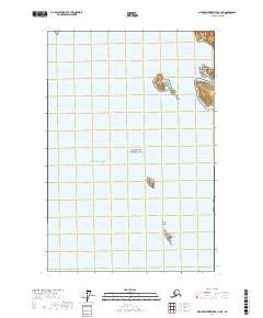
2017 Map of Mount Fairweather C-1 NE
USGS Topo · Published 2017About this map
Glacier Bay National Park spans the waters and remote islands of the northern Glacier Bay region, where the open Gulf of Alaska meets protected inlets. This maritime landscape is defined by its scattered landmasses, including the Sturgess Island and the bird-rich Marble Islands. The map illustrates a coastline in transition, as retreating ice and rising landmasses continue to reshape the topography of this wilderness area.
Find a feature on this map
13 named features on this map. Tap any name to fly to it.
Don’t see what you’re looking for? This feature index may not catch every label — zoom into the map to look around manually.
Map Details
Editions of this 2017 Mount Fairweather C-1 NE Map
This is the sole edition of this map. No revisions or reprints were ever made.
Other maps of this area

1948 · Juneau C-6
USGS Topo · 1:63,360

1948 · Mount Fairweather D-1
USGS Topo · 1:63,360

1948 · Mount Fairweather C-1
USGS Topo · 1:63,360

1949 · Mount Fairweather C-1
USGS Topo · 1:63,360

1949 · Juneau D-6
USGS Topo · 1:63,360

1950 · Juneau C-6
USGS Topo · 1:63,360

1951 · Juneau
USGS Topo · 1:250,000

1951 · Mt Fairweather
USGS Topo · 1:250,000

1954 · Mount Fairweather D-1
USGS Topo · 1:63,360

1961 · Mt Fairweather
USGS Topo · 1:250,000