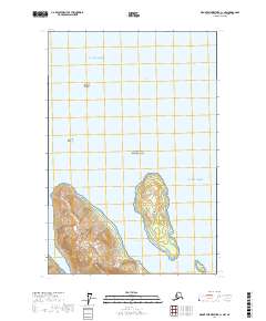
2017 Map of Mount Fairweather C-1 NW
USGS Topo · Published 2017About this map
Glacier Bay National Park encompasses this coastal Alaskan landscape, where the waters of the Gulf of Alaska meet a complex network of islands and high terrain. The topography is dominated by the steep rises of Marble Mtn on the western shore, facing the sheltered waters of Whidbey Passage. This waterway separates the mainland from Drake Island, a significant landmass characterized by its own distinct elevation and contours. Smaller features like Lone Island and Geikie Rock mark the open waters of Glacier Bay to the north, illustrating the navigational hazards and landmarks of this maritime environment. The mapping reveals a coastline of deep inlets like Shay Cove, providing a detailed look at the interface between the glacial waters and the mountainous terrain of the Hoonah-Angoon Census Area.
Find a feature on this map
14 named features on this map. Tap any name to fly to it.
Don’t see what you’re looking for? This feature index may not catch every label — zoom into the map to look around manually.
Map Details
Editions of this 2017 Mount Fairweather C-1 NW Map
This is the sole edition of this map. No revisions or reprints were ever made.
Other maps of this area

1948 · Mount Fairweather D-1
USGS Topo · 1:63,360

1948 · Mount Fairweather D-2
USGS Topo · 1:63,360

1948 · Mount Fairweather C-1
USGS Topo · 1:63,360

1948 · Mount Fairweather C-2
USGS Topo · 1:63,360

1949 · Mount Fairweather C-1
USGS Topo · 1:63,360

1950 · Mount Fairweather D-2
USGS Topo · 1:63,360

1950 · Mount Fairweather C-2
USGS Topo · 1:63,360

1951 · Mt Fairweather
USGS Topo · 1:250,000

1954 · Mount Fairweather D-1
USGS Topo · 1:63,360

1961 · Mt Fairweather
USGS Topo · 1:250,000