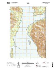
2017 Map of Mount Fairweather D-1 SE
USGS Topo · Published 2017About this map
Glacier Bay National Park dominates this marine and coastal landscape, where the shifting ice of the late twentieth and early twenty-first centuries has left behind a complex network of deep water inlets. The central corridor of Muir Inlet serves as the primary artery for the region, flanked by prominent coastal markers like Muir Point and Garforth Island. To the east, the terrain rises sharply toward the summit of Mt Wright, overlooking the sheltered waters of Adams Inlet. The map illustrates the maritime hazards and navigational landmarks essential to this coastline, from the tidal reaches of Sebree Cove and Maquinna Cove to the underwater risks at Caroline Shoal. The proximity of Sebree Island and Point George highlights the narrow channels and bays that define this protected wilderness area.
Find a feature on this map
16 named features on this map. Tap any name to fly to it.
Don’t see what you’re looking for? This feature index may not catch every label — zoom into the map to look around manually.
Map Details
Editions of this 2017 Mount Fairweather D-1 SE Map
This is the sole edition of this map. No revisions or reprints were ever made.
Other maps of this area

1948 · Juneau C-6
USGS Topo · 1:63,360

1948 · Mount Fairweather D-1
USGS Topo · 1:63,360

1948 · Mount Fairweather C-1
USGS Topo · 1:63,360

1949 · Mount Fairweather C-1
USGS Topo · 1:63,360

1949 · Juneau D-6
USGS Topo · 1:63,360

1950 · Juneau C-6
USGS Topo · 1:63,360

1951 · Juneau
USGS Topo · 1:250,000

1951 · Mt Fairweather
USGS Topo · 1:250,000

1954 · Mount Fairweather D-1
USGS Topo · 1:63,360

1961 · Mt Fairweather
USGS Topo · 1:250,000