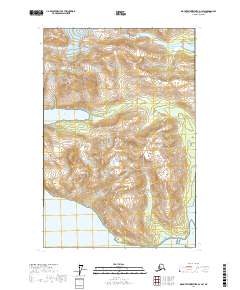
2017 Map of Mount Fairweather D-1 SW
USGS Topo · Published 2017About this map
Glacier Bay National Park encompasses this wilderness landscape where glacial retreat continues to reshape the coastline and mountain terrain. The dynamic environment is dominated by the flow of Morse Glacier in the north and the deep waters of the Tidal Inlet to the west. Landforms such as Oberlin Ridge and Pyramid Peak rise sharply from the water's edge, illustrating the dramatic elevation changes characteristic of this portion of the Alaska panhandle. Along the southeastern shore, Tlingit Point and Sebree Cove provide geographic markers for maritime navigation within Glacier Bay. This 2017 study documents the modern contours of Ice Valley and the surrounding peaks, reflecting contemporary shorelines and ice positions that are critical for understanding the region's environmental evolution.
Find a feature on this map
15 named features on this map. Tap any name to fly to it.
Don’t see what you’re looking for? This feature index may not catch every label — zoom into the map to look around manually.
Map Details
Editions of this 2017 Mount Fairweather D-1 SW Map
This is the sole edition of this map. No revisions or reprints were ever made.
Other maps of this area

1948 · Mount Fairweather D-1
USGS Topo · 1:63,360

1948 · Mount Fairweather D-2
USGS Topo · 1:63,360

1948 · Mount Fairweather C-1
USGS Topo · 1:63,360

1948 · Mount Fairweather C-2
USGS Topo · 1:63,360

1949 · Mount Fairweather C-1
USGS Topo · 1:63,360

1950 · Mount Fairweather D-2
USGS Topo · 1:63,360

1950 · Mount Fairweather C-2
USGS Topo · 1:63,360

1951 · Mt Fairweather
USGS Topo · 1:250,000

1954 · Mount Fairweather D-1
USGS Topo · 1:63,360

1961 · Mt Fairweather
USGS Topo · 1:250,000