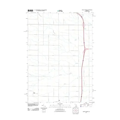
2011 Map of Mount Forest
USGS Topo · Published 2011About this map
Mount Forest and Nine Mile stand as the primary community centers in this northern portion of Bay County. The landscape is defined by a dense grid of rural roads and an extensive network of water management features, including the Sunsmith Drain, Budd Drain, and Selleck Drain. These man-made channels support the agricultural utility of the land between the natural courses of the Middle Branch Pine River and South Branch Pine River. In the southern half of the quadrangle, Saganing Creek winds through the terrain, while major transportation arteries like the north-south interstate corridor facilitate travel through the township. The map reveals a structured settlement pattern where residential clusters and farmsteads are closely tied to the intersection of county roads such as Bentley Rd and 8 Mile Rd.
Find a feature on this map
47 named features on this map. Tap any name to fly to it.
Don’t see what you’re looking for? This feature index may not catch every label — zoom into the map to look around manually.
Map Details
Editions of this 2011 Mount Forest Map
This is the sole edition of this map. No revisions or reprints were ever made.
Other maps of this area

1954 · Traverse City
USGS Topo · 1:250,000

1954 · Midland
USGS Topo · 1:250,000

1954 · Flint
USGS Topo · 1:250,000

1954 · Tawas City
USGS Topo · 1:250,000

1958 · Traverse City
USGS Topo · 1:250,000

1958 · Flint
USGS Topo · 1:250,000

1958 · Tawas City
USGS Topo · 1:250,000

1958 · Midland
USGS Topo · 1:250,000

1959 · Midland
USGS Topo · 1:250,000

1966 · Midland
USGS Topo · 1:250,000