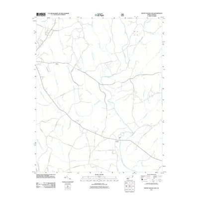
2011 Map of Mount Gilead East
USGS Topo · Published 2011About this map
Little River and Big Town Creek define the drainage of this Montgomery County landscape, where rural road networks connect long-standing agricultural holdings and family estates. The presence of Littles Mill on the river near the southern portion of the map indicates a history of water-powered industry central to the local economy. Genealogists can find significant landmarks such as Sharon Cemetery in the northwest and Ledbetter Cemetery further south, providing anchors for family history research. The naming of numerous water bodies, including Thickety Creek, Susies Creek, and Buffalo Creek, reflects a terrain deeply divided by small tributaries and branches. Roads like Town Creek Mound Rd and Hearne Farm Rd suggest paths between historic settlements and archaeological sites within the Piedmont region.
Find a feature on this map
58 named features on this map. Tap any name to fly to it.
Don’t see what you’re looking for? This feature index may not catch every label — zoom into the map to look around manually.
Map Details
Editions of this 2011 Mount Gilead East Map
This is the sole edition of this map. No revisions or reprints were ever made.
Other maps of this area

1942 · Troy
USGS Topo · 1:125,000

1953 · Raleigh
USGS Topo · 1:250,000

1953 · Charlotte
USGS Topo · 1:250,000

1954 · Charlotte
USGS Topo · 1:250,000

1954 · Raleigh
USGS Topo · 1:250,000

1956 · Mangum
USGS Topo · 1:24,000

1956 · Mount Gilead East
USGS Topo · 1:24,000

1956 · Ellerbe
USGS Topo · 1:24,000

1956 · Harrisville
USGS Topo · 1:24,000

1956 · Ansonville
USGS Topo · 1:24,000