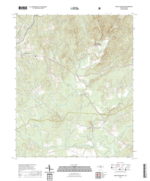
2022 Map of Mount Gilead East
USGS Topo · Published 2022About this map
The town of Mount Gilead anchors the western edge of this landscape, where the street grid transitions into the sprawling timberlands and creek valleys of the Uwharrie National Forest. The eastern half of the map is defined by the winding course of the Little River, which receives numerous tributaries including Big Town Cr, Little Town Cr, and Little Rocky Cr. This drainage pattern has historically influenced settlement and road placement, with routes like NC Highway 731 E and Thickety Creek Rd navigating the high ground between watersheds.
Find a feature on this map
72 named features on this map. Tap any name to fly to it.
Don’t see what you’re looking for? This feature index may not catch every label — zoom into the map to look around manually.
Map Details
Editions of this 2022 Mount Gilead East Map
This is the sole edition of this map. No revisions or reprints were ever made.
Other maps of this area

1942 · Troy
USGS Topo · 1:125,000

1953 · Raleigh
USGS Topo · 1:250,000

1953 · Charlotte
USGS Topo · 1:250,000

1954 · Charlotte
USGS Topo · 1:250,000

1954 · Raleigh
USGS Topo · 1:250,000

1956 · Mangum
USGS Topo · 1:24,000

1956 · Mount Gilead East
USGS Topo · 1:24,000

1956 · Ellerbe
USGS Topo · 1:24,000

1956 · Harrisville
USGS Topo · 1:24,000

1956 · Ansonville
USGS Topo · 1:24,000