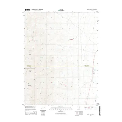
2014 Map of Mount Grafton
USGS Topo · Published 2014About this map
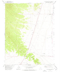
Mount Grafton dominates this high-altitude landscape within the Schell Creek Range, marking a dramatic divide between steep alpine terrain and the level expanse of Lake Valley to the east. This 2014 survey documents a critical watershed defined by a high density of named springs, such as Deer Track Spring, Schwartz Tunnel Spring, and Wambolt Springs, which feed a series of eastward-draining creeks including Mill Cr and Wambolt Cr. The intersection of the White Pine and Lincoln County line bisects the quadrangle, highlighting the administrative boundary in this sparsely populated region. Human activity is concentrated along the eastern corridor where Geyser Rd skirts the valley floor, providing access to the Geyser Ranch Airport and nearby Geyser Ranch Springs. The map reveals a land managed for its water resources and ranching potential, with canyons like Cottonwood Canyon and Lanter Canyon cutting through the limestone and volcanic layers of the range.
Find a feature on this map
33 named features on this map. Tap any name to fly to it.
Don’t see what you’re looking for? This feature index may not catch every label — zoom into the map to look around manually.
Map Details
Editions of this 2014 Mount Grafton Map
This is the sole edition of this map. No revisions or reprints were ever made.
Other maps of this area

1956 · Lund
USGS Topo · 1:250,000

1960 · Lund
USGS Topo · 1:250,000

1969 · Parker Station
USGS Topo · 1:24,000

1969 · Shingle Pass SE
USGS Topo · 1:24,000

1973 · Gouge Eye Well
USGS Topo · 1:24,000

1973 · Cattle Camp Spring
USGS Topo · 1:24,000
1973 · Mount Grafton NE
USGS Topo · 1:24,000
1977 · Bullwhack Summit
USGS Topo · 1:24,000
1978 · Mt. Grafton
USGS Topo · 1:24,000
1978 · Lake Valley Summit
USGS Topo · 1:24,000