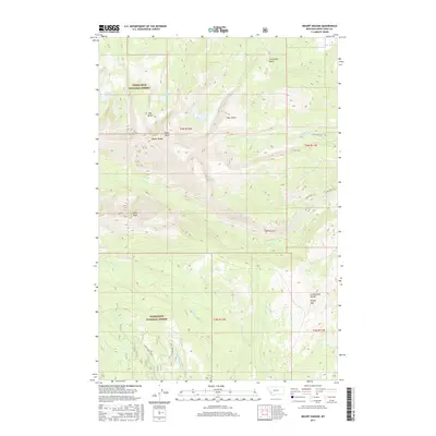
2017 Map of Mount Haggin
USGS Topo · Published 2017About this map
Mount Haggin and the crest of the Continental Divide dominate this high-altitude section of the Deerlodge National Forest south of Anaconda. The landscape is defined by a dense network of gulches and drainages, where Slaughterhouse Cr and Upper Corral Creek flow south while waters like Mill Cr and Clear Cr carve out the northern slopes. The mapping reveals a preserved mountain wilderness accessed by established paths such as Rosa Trl and Whipperwill Trl. High-mountain basins hold isolated water bodies like Barker Lakes, Haggin Lake, and Hearst Lake, providing a detailed view of the hydrography at the roof of the Rockies. The concentration of gulches, including Big Gulch, Grays Gulch, and Fifer Gulch, illustrates the complex erosion patterns typical of this portion of the Anaconda Range.
Find a feature on this map
32 named features on this map. Tap any name to fly to it.
Don’t see what you’re looking for? This feature index may not catch every label — zoom into the map to look around manually.
Map Details
Editions of this 2017 Mount Haggin Map
This is the sole edition of this map. No revisions or reprints were ever made.
Other maps of this area

1889 · Helena
USGS Topo · 1:250,000

1893 · Helena
USGS Topo · 1:250,000

1893 · Dillon
USGS Topo · 1:250,000

1899 · Helena
USGS Topo · 1:250,000

1903 · Helena
USGS Topo · 1:250,000

1908 · Philipsburg
USGS Topo · 1:125,000

1947 · Butte
USGS Topo · 1:250,000

1955 · Dillon
USGS Topo · 1:250,000

1957 · Dillon
USGS Topo · 1:250,000

1958 · Butte
USGS Topo · 1:250,000