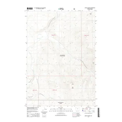
2015 Map of Mount Hancock
USGS Topo · Published 2015About this map
The Snake River and Heart River meet within the high-elevation wilderness of Yellowstone National Park, carving through a landscape defined by significant rises like Mt Hancock and Big Game Ridge. This 2015 survey details a complex network of backcountry routes at the southern edge of the park and the northern reaches of Teton National Forest. The Continental Divide National Scenic Trail winds across the terrain, intersecting with specialized paths such as the Harebell-Fox Creek Trail and the Snake River Cutoff Trail. Further south, Harebell Creek flows beneath Barlow Peak, marking a remote transition between the national park and forest lands. The map serves as a primary record of the trail systems and hydrological connections, including Basin Creek and Sickle Creek, that characterize this undeveloped section of the Wyoming wilderness.
Find a feature on this map
21 named features on this map. Tap any name to fly to it.
Don’t see what you’re looking for? This feature index may not catch every label — zoom into the map to look around manually.
Map Details
Editions of this 2015 Mount Hancock Map
This is the sole edition of this map. No revisions or reprints were ever made.
Other maps of this area

1885 · Lake
USGS Topo · 1:125,000

1886 · Shoshone
USGS Topo · 1:125,000

1888 · Shoshone
USGS Topo · 1:125,000

1895 · Shoshone
USGS Topo · 1:125,000

1895 · Lake
USGS Topo · 1:125,000

1896 · Lake
USGS Topo · 1:125,000

1901 · Shoshone
USGS Topo · 1:125,000

1901 · Lake
USGS Topo · 1:125,000

1906 · Lake
USGS Topo · 1:125,000

1908 · Shoshone
USGS Topo · 1:125,000