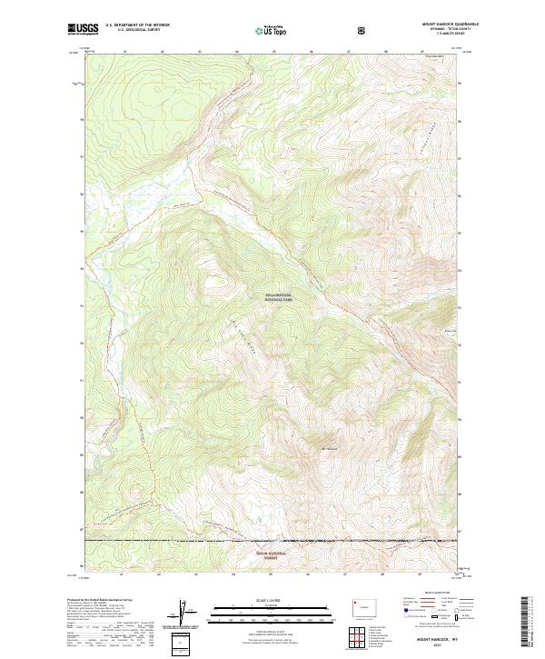
2021 Map of Mount Hancock
USGS Topo · Published 2021About this map
Mt Hancock and Big Game Ridge dominate this wilderness landscape within the southern reaches of Yellowstone National Park. This terrain is defined by its extensive trail network and watershed systems, notably where the Snake River Headwaters Wild and Scenic River carves through the mountains. The presence of the Continental Divide National Scenic Trl provides a critical geographic reference point as it winds past peaks like Overlook Mtn and Barlow Peak. Further south, the boundary with Teton National Forest is marked by the confluence of the Snake River and Harebell Cr. This 2021 survey illustrates a region largely shaped by its protected status, focusing on the natural topography and primitive access routes such as the Snake River Canyon Trl and the South Boundary Trail: South Entrance-Harebell Trl rather than human settlement.
Find a feature on this map
24 named features on this map. Tap any name to fly to it.
Don’t see what you’re looking for? This feature index may not catch every label — zoom into the map to look around manually.
Map Details
Editions of this 2021 Mount Hancock Map
This is the sole edition of this map. No revisions or reprints were ever made.
Other maps of this area

1885 · Lake
USGS Topo · 1:125,000

1886 · Shoshone
USGS Topo · 1:125,000

1888 · Shoshone
USGS Topo · 1:125,000

1895 · Shoshone
USGS Topo · 1:125,000

1895 · Lake
USGS Topo · 1:125,000

1896 · Lake
USGS Topo · 1:125,000

1901 · Shoshone
USGS Topo · 1:125,000

1901 · Lake
USGS Topo · 1:125,000

1906 · Lake
USGS Topo · 1:125,000

1908 · Shoshone
USGS Topo · 1:125,000