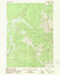
1989 Map of Mount Hancock
USGS Topo · Published 1989About this map
Yellowstone National Park and the Teton National Forest meet in this high-altitude landscape where the Continental Divide dictates the flow of several major mountain waterways. The map captures a critical convergence of drainage systems, showing the headwaters of the Snake River winding south out of the park, while the Heart River flows from Heart Lake in the north. The rugged terrain is defined by massive landforms like Big Game Ridge and Chicken Ridge, with the summit of Mount Hancock serving as a prominent landmark at the center of the sheet.
Find a feature on this map
22 named features on this map. Tap any name to fly to it.
Don’t see what you’re looking for? This feature index may not catch every label — zoom into the map to look around manually.
Map Details
Editions of this 1989 Mount Hancock Map
This is the sole edition of this map. No revisions or reprints were ever made.
Other maps of this area

1885 · Lake
USGS Topo · 1:125,000

1886 · Shoshone
USGS Topo · 1:125,000

1888 · Shoshone
USGS Topo · 1:125,000

1895 · Shoshone
USGS Topo · 1:125,000

1895 · Lake
USGS Topo · 1:125,000

1896 · Lake
USGS Topo · 1:125,000

1901 · Shoshone
USGS Topo · 1:125,000

1901 · Lake
USGS Topo · 1:125,000

1906 · Lake
USGS Topo · 1:125,000

1908 · Shoshone
USGS Topo · 1:125,000