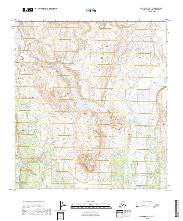
2024 Map of Mount Hayes A-3 SW
USGS Topo · Published 2024About this map
The settlement of Paxson serves as a focal point at the junction of critical Alaskan infrastructure and a complex network of waterways. Located in a high-elevation landscape, the map reveals the industrial footprint of the Alaska Pipeline and the Richardson Highway as they traverse the corridor near the Gulkana River. This region is defined by its glacial hydrology, where Summit Lake and Upper Fish Lake sit among high peaks like Wolverine Mtn. The terrain demonstrates a sharp contrast between the engineering of the trans-Alaska corridor and the wild drainages of the Gakona River and Fish Creek. For those tracing local paths, the Wolverine Mountain Trl provides a terrestrial connection through the foothills east of the Richardson corridor.
Find a feature on this map
17 named features on this map. Tap any name to fly to it.
Don’t see what you’re looking for? This feature index may not catch every label — zoom into the map to look around manually.
Map Details
Editions of this 2024 Mount Hayes A-3 SW Map
This is the sole edition of this map. No revisions or reprints were ever made.
Other maps of this area

1949 · Mount Hayes A-4
USGS Topo · 1:63,360

1949 · Gulkana D-3
USGS Topo · 1:63,360

1950 · Mount Hayes
USGS Topo · 1:250,000

1950 · Gulkana D-4
USGS Topo · 1:63,360

1950 · Mount Hayes A-3
USGS Topo · 1:63,360

1951 · Gulkana
USGS Topo · 1:250,000

1951 · Mount Hayes
USGS Topo · 1:250,000

1952 · Gulkana D-3
USGS Topo · 1:63,360

1952 · Mount Hayes A-3
USGS Topo · 1:63,360

1952 · Gulkana D-4
USGS Topo · 1:63,360