
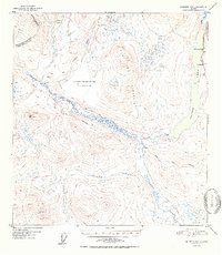
1952 Map of Gulkana D-4
USGS Topo · Published 1952About this map
Paxson Lake and the Gulkana River dominate this interior Alaskan landscape, documented from aerial photography taken in 1949. Along the eastern edge, the Richardson Highway provides the primary corridor for travel, connecting isolated outposts such as Sportsman Lodge and Hufmans. The map illustrates a transitional wilderness where mechanized travel and traditional routes overlap, evidenced by the numerous paths labeled as Tractor Trail and simple Trail markings that spiderweb away from the highway toward the backcountry.
Find a feature on this map
20 named features on this map. Tap any name to fly to it.
Don’t see what you’re looking for? This feature index may not catch every label — zoom into the map to look around manually.
Map Details
Editions of this 1952 Gulkana D-4 Map
2 editions found
Other maps of this area

1949 · Mount Hayes A-4
USGS Topo · 1:63,360

1949 · Gulkana D-3
USGS Topo · 1:63,360

1949 · Mount Hayes A-5
USGS Topo · 1:63,360

1950 · Mount Hayes
USGS Topo · 1:250,000

1950 · Gulkana D-4
USGS Topo · 1:63,360

1950 · Mount Hayes A-3
USGS Topo · 1:63,360

1950 · Gulkana C-3
USGS Topo · 1:63,360

1950 · Gulkana C-4
USGS Topo · 1:63,360

1951 · Gulkana
USGS Topo · 1:250,000

1951 · Mount Hayes
USGS Topo · 1:250,000