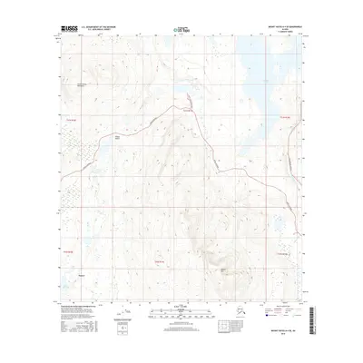
2016 Map of Mount Hayes A-4 SE
USGS Topo · Published 2016About this map
Paxson serves as a vital interior junction where the Denali Highway and the Richardson Highway converge near the headwaters of the Gulkana River. The terrain is dominated by the high-elevation peaks of the Amphitheater Mountains to the northwest and the prominent rise of Paxson Mtn to the south. This alpine landscape is defined by its glacial history, evidenced by numerous small water bodies such as Octopus Lake and the aptly named Wait-A-Bit Lake. In the northeast, the southern tip of Summit Lake marks the divide of this sub-arctic watershed. The presence of the 7 Mile Lake Access Road and the winding descent through Hungry Hollow illustrate the thin but essential infrastructure connecting this portion of the Unorganized Borough to the rest of the Alaskan interior.
Find a feature on this map
17 named features on this map. Tap any name to fly to it.
Don’t see what you’re looking for? This feature index may not catch every label — zoom into the map to look around manually.
Map Details
Editions of this 2016 Mount Hayes A-4 SE Map
This is the sole edition of this map. No revisions or reprints were ever made.
Other maps of this area

1949 · Mount Hayes A-4
USGS Topo · 1:63,360

1949 · Gulkana D-3
USGS Topo · 1:63,360

1950 · Mount Hayes
USGS Topo · 1:250,000

1950 · Gulkana D-4
USGS Topo · 1:63,360

1950 · Mount Hayes A-3
USGS Topo · 1:63,360

1951 · Gulkana
USGS Topo · 1:250,000

1951 · Mount Hayes
USGS Topo · 1:250,000

1952 · Gulkana D-3
USGS Topo · 1:63,360

1952 · Mount Hayes A-3
USGS Topo · 1:63,360

1952 · Gulkana D-4
USGS Topo · 1:63,360