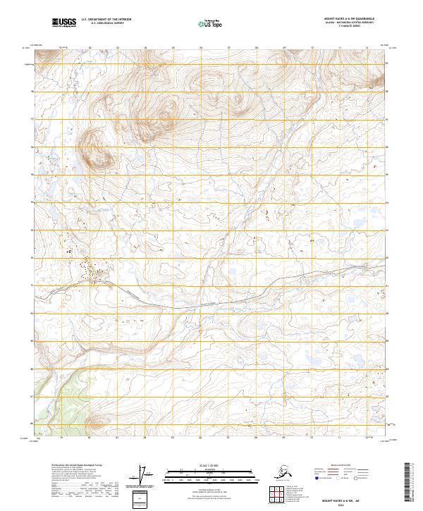
2024 Map of Mount Hayes A-6 SW
USGS Topo · Published 2024About this map
Denali Highway cuts across this interior Alaskan landscape, providing the primary east-west route through the Matanuska-Susitna region. The terrain is defined by a dense network of braided glacial streams and drainages, including the prominent Clearwater Creek and its tributary, Little Clearwater Creek. These water systems, alongside Osar Creek and the winding Corkscrew Creek, illustrate the natural drainage patterns of the Alaskan wilderness. The map details the Township and Range boundaries, such as t21s r4e and t21s r5e, which organize this largely undeveloped territory. Researchers can observe how the highway follows the natural contours of the land, navigating between various creek basins and upland features.
Find a feature on this map
9 named features on this map. Tap any name to fly to it.
Don’t see what you’re looking for? This feature index may not catch every label — zoom into the map to look around manually.
Map Details
Editions of this 2024 Mount Hayes A-6 SW Map
This is the sole edition of this map. No revisions or reprints were ever made.
Other maps of this area

1949 · Healy A-1
USGS Topo · 1:63,360

1950 · Talkeetna Mountains
USGS Topo · 1:250,000

1950 · Mount Hayes
USGS Topo · 1:250,000

1950 · Mount Hayes A-6
USGS Topo · 1:63,360

1951 · Healy
USGS Topo · 1:250,000

1951 · Gulkana
USGS Topo · 1:250,000

1951 · Mount Hayes
USGS Topo · 1:250,000

1951 · Gulkana D-6
USGS Topo · 1:63,360

1951 · Talkeetna Mountains D-1
USGS Topo · 1:63,360
1952 · Talkeetna Mountains D-1
USGS Topo · 1:63,360