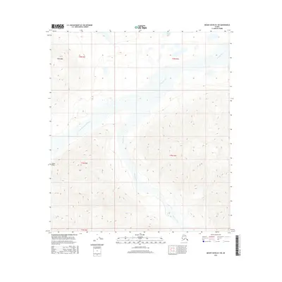
2016 Map of Mount Hayes B-1 NE
USGS Topo · Published 2016About this map
Robertson River dominates this portion of the interior, carving a wide braided channel through the northern foothills of the Alaska Range. The map documents a landscape where glacial runoff and shifting gravel bars dictate the topography, with the West Fork Robertson River joining the main stem amidst a complex network of wetlands and seasonal watercourses. To the northwest, the small settlement near Dot Lake sits at the edge of the river's influence, while Monte Lake occupies a lonely depression in the higher ground to the north. This survey illustrates the transition from the high peaks of the range into the expansive river valleys, showing the vast unorganized lands of the eastern interior long after the initial pioneer era but before any significant industrial footprint reached these specific drainages.
Find a feature on this map
10 named features on this map. Tap any name to fly to it.
Don’t see what you’re looking for? This feature index may not catch every label — zoom into the map to look around manually.
Map Details
Editions of this 2016 Mount Hayes B-1 NE Map
This is the sole edition of this map. No revisions or reprints were ever made.
Other maps of this area

1949 · Tanacross
USGS Topo · 1:250,000

1949 · Tanacross B-6
USGS Topo · 1:63,360

1950 · Tanacross
USGS Topo · 1:250,000

1950 · Mount Hayes
USGS Topo · 1:250,000

1951 · Mount Hayes
USGS Topo · 1:250,000

1951 · Tanacross B-6
USGS Topo · 1:63,360

1954 · Mount Hayes B-1
USGS Topo · 1:63,360

1954 · Tanacross C-6
USGS Topo · 1:63,360

1954 · Mount Hayes C-1
USGS Topo · 1:63,360

1955 · Mount Hayes C-1
USGS Topo · 1:63,360