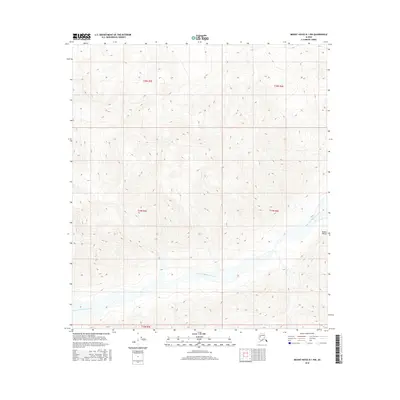
2016 Map of Mount Hayes B-1 NW
USGS Topo · Published 2016About this map
The West Fork Robertson River carves a braided path through the high-elevation terrain shown in this 2016 survey. This portion of the Alaska Range is characterized by extreme relief, where the river's multiple channels indicate a dynamic glacial drainage system at work. The map serves as a primary record of the Public Land Survey System for the Unorganized Borough, documenting the townships of t20n r5e, t20n r6e, t19n r5e, t19n r6e, and t18n r5e. While the land remains largely undeveloped, the intricate contour lines detail the steep ridges and vast valley floors that define this interior Alaskan wilderness.
Find a feature on this map
7 named features on this map. Tap any name to fly to it.
Don’t see what you’re looking for? This feature index may not catch every label — zoom into the map to look around manually.
Map Details
Editions of this 2016 Mount Hayes B-1 NW Map
This is the sole edition of this map. No revisions or reprints were ever made.
Other maps of this area

1950 · Mount Hayes
USGS Topo · 1:250,000

1951 · Mount Hayes
USGS Topo · 1:250,000

1954 · Mount Hayes B-1
USGS Topo · 1:63,360

1954 · Mount Hayes C-1
USGS Topo · 1:63,360

1955 · Mount Hayes C-2
USGS Topo · 1:63,360

1955 · Mount Hayes B-2
USGS Topo · 1:63,360

1955 · Mount Hayes C-1
USGS Topo · 1:63,360
1955 · Mount Hayes B-1
USGS Topo · 1:63,360

1955 · Mount Hayes
USGS Topo · 1:250,000
2016 · Mount Hayes B-2 SE
USGS Topo · 1:25,000