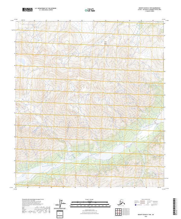
2024 Map of Mount Hayes B-1 NW
USGS Topo · Published 2024About this map
West Fork Robertson River meanders across this interior landscape within the Southeast Fairbanks Census Area, carving a path through the northern foothills of the Alaska Range. This topographic study provides a detailed look at the hydrology and high-altitude terrain of the region, where the braided river channels contrast with the steep contouring of the surrounding peaks. In the northern portion of the quadrangle, the presence of Dot Lake serves as a prominent landmark amidst the intricate drainage patterns that define this subarctic environment. The map also delineates several township and range boundaries, including t20n r5e and t19n r6e, which provide a formal grid for understanding the distribution of public lands and survey tracts in this part of the Alaskan interior.
Find a feature on this map
8 named features on this map. Tap any name to fly to it.
Don’t see what you’re looking for? This feature index may not catch every label — zoom into the map to look around manually.
Map Details
Editions of this 2024 Mount Hayes B-1 NW Map
This is the sole edition of this map. No revisions or reprints were ever made.
Other maps of this area

1950 · Mount Hayes
USGS Topo · 1:250,000

1951 · Mount Hayes
USGS Topo · 1:250,000

1954 · Mount Hayes B-1
USGS Topo · 1:63,360

1954 · Mount Hayes C-1
USGS Topo · 1:63,360

1955 · Mount Hayes C-2
USGS Topo · 1:63,360

1955 · Mount Hayes B-2
USGS Topo · 1:63,360

1955 · Mount Hayes C-1
USGS Topo · 1:63,360
1955 · Mount Hayes B-1
USGS Topo · 1:63,360

1955 · Mount Hayes
USGS Topo · 1:250,000
2016 · Mount Hayes B-2 SE
USGS Topo · 1:25,000