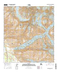
2016 Map of Mount Hayes B-4 NE
USGS Topo · Published 2016About this map
Castner Glacier and Fels Glacier dominate this high-altitude landscape within the Alaska Range, where massive ice flows carve deep valleys into the surrounding peaks. The map reveals a corridor of critical infrastructure following the natural path of Castner Creek and Lower Miller Creek. Here, the modern Alaska Pipeline and the Richardson Highway run parallel along the southwestern edge of the sheet, providing a vital north-south link through the subarctic interior.
Find a feature on this map
24 named features on this map. Tap any name to fly to it.
Don’t see what you’re looking for? This feature index may not catch every label — zoom into the map to look around manually.
Map Details
Editions of this 2016 Mount Hayes B-4 NE Map
This is the sole edition of this map. No revisions or reprints were ever made.
Other maps of this area

1950 · Mount Hayes
USGS Topo · 1:250,000

1950 · Mount Hayes C-4
USGS Topo · 1:63,360

1951 · Mount Hayes
USGS Topo · 1:250,000

1952 · Mount Hayes C-4
USGS Topo · 1:63,360

1952 · Mount Hayes B-4
USGS Topo · 1:63,360

1954 · Mount Hayes C-3
USGS Topo · 1:63,360

1954 · Mount Hayes B-4
USGS Topo · 1:63,360

1955 · Mount Hayes B-3
USGS Topo · 1:63,360

1955 · Mount Hayes C-3
USGS Topo · 1:63,360

1955 · Mount Hayes
USGS Topo · 1:250,000