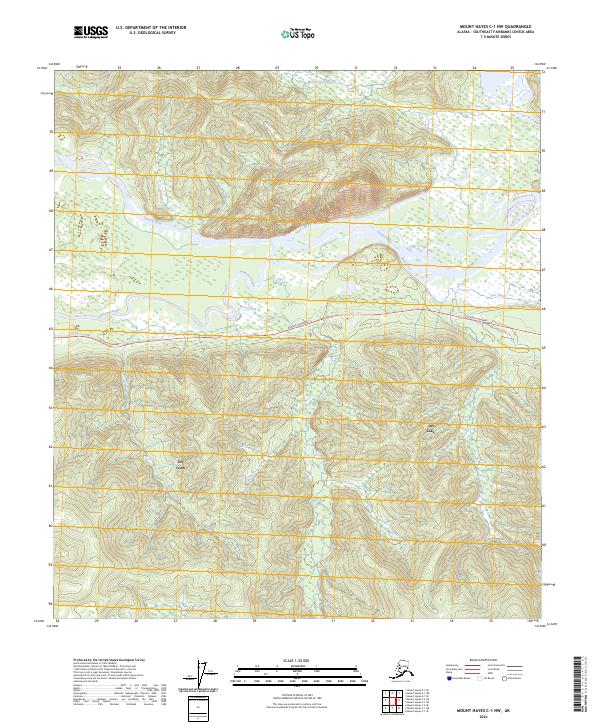
2024 Map of Mount Hayes C-1 NW
USGS Topo · Published 2024About this map
Dot Lake serves as a focal point in this portion of the Southeast Fairbanks Census Area, situated south of the braided channels of the Tanana River. The landscape is defined by the vital corridor of the Alaska Highway, which cuts across the central portion of the map, providing the primary overland connection through this interior region. The hydrology of the area is complex, featuring a network of drainages including Johnson Slough and Berry Creek that feed into the larger river system. North of the highway, the terrain rises toward the foothills, marked by Sand Creek and Sam Creek. This 2024 survey documents the modern state of the wilderness and transportation infrastructure, showing how the historical highway route remains the backbone of local geography near Sears Creek and Dry Creek.
Find a feature on this map
15 named features on this map. Tap any name to fly to it.
Don’t see what you’re looking for? This feature index may not catch every label — zoom into the map to look around manually.
Map Details
Editions of this 2024 Mount Hayes C-1 NW Map
This is the sole edition of this map. No revisions or reprints were ever made.
Other maps of this area

1950 · Mount Hayes
USGS Topo · 1:250,000

1951 · Mount Hayes
USGS Topo · 1:250,000

1954 · Mount Hayes D-2
USGS Topo · 1:63,360

1954 · Mount Hayes D-1
USGS Topo · 1:63,360

1954 · Mount Hayes C-1
USGS Topo · 1:63,360

1955 · Mount Hayes C-2
USGS Topo · 1:63,360

1955 · Mount Hayes C-1
USGS Topo · 1:63,360

1955 · Mount Hayes D-2
USGS Topo · 1:63,360

1955 · Mount Hayes
USGS Topo · 1:250,000
2016 · Mount Hayes C-1 NE
USGS Topo · 1:25,000