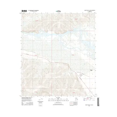
2016 Map of Mount Hayes C-1 NE
USGS Topo · Published 2016About this map
Dot Lake Village serves as the primary settlement on this Interior Alaska sheet, situated just south of the braided channels of the Tanana River. The community is anchored by its position along the Alaska Highway, with a small local grid of streets including Luke Avenue, Vogle Avenue, and Miller Avenue providing access to the namesake Dot Lake. This 2016 survey illustrates the intersection of a traditional riverine landscape with critical modern transportation infrastructure. Beyond the village, the terrain is defined by low-lying wetlands and complex water systems, including the meandering paths of Billy Creek, Sam Cr, and Chief Cr. To the north and south, the topographic contours rise into upland sections of the Tanana Valley, where the township and range lines of t22n r7e and surrounding sections organize this vast, sparsely populated region.
Find a feature on this map
17 named features on this map. Tap any name to fly to it.
Don’t see what you’re looking for? This feature index may not catch every label — zoom into the map to look around manually.
Map Details
Editions of this 2016 Mount Hayes C-1 NE Map
This is the sole edition of this map. No revisions or reprints were ever made.
Other maps of this area

1949 · Tanacross
USGS Topo · 1:250,000

1950 · Tanacross
USGS Topo · 1:250,000

1950 · Mount Hayes
USGS Topo · 1:250,000

1951 · Mount Hayes
USGS Topo · 1:250,000

1954 · Tanacross C-6
USGS Topo · 1:63,360

1954 · Mount Hayes D-1
USGS Topo · 1:63,360

1954 · Tanacross D-6
USGS Topo · 1:63,360

1954 · Mount Hayes C-1
USGS Topo · 1:63,360

1955 · Mount Hayes C-1
USGS Topo · 1:63,360
1955 · Tanacross C-6
USGS Topo · 1:63,360