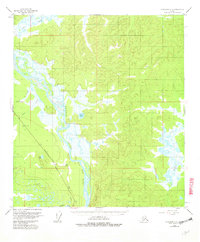
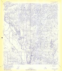
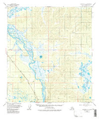
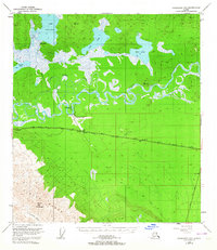
1955 Map of Tanacross C-6
USGS Topo · Published 1962About this map
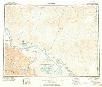
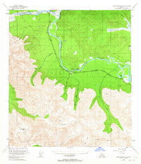
The Tanana River dominates this mid-century subarctic landscape, carving a wide alluvial valley defined by complex braids and seasonal wetlands. Recorded in the mid-1950s with later updates, the survey highlights the corridor of the Aboveground Alaska Pipeline Highway, a critical infrastructure artery tracing the western bank of the river. The confluence with the Robertson River to the south and the dramatic rise of the Tower Bluffs illustrate the geological transition between high-velocity glacial runoff and the slower, meandering waters of the interior basins.
Find a feature on this map
21 named features on this map. Tap any name to fly to it.
Don’t see what you’re looking for? This feature index may not catch every label — zoom into the map to look around manually.
Map Details
Editions of this 1955 Tanacross C-6 Map
5 editions found


Other maps of this area
1948 · Tanacross B-5
USGS Topo · 1:63,360
1949 · Tanacross
USGS Topo · 1:250,000
1949 · Tanacross B-6
USGS Topo · 1:63,360
1950 · Tanacross
USGS Topo · 1:250,000

1950 · Mount Hayes
USGS Topo · 1:250,000
1951 · Mount Hayes
USGS Topo · 1:250,000

1951 · Tanacross B-6
USGS Topo · 1:63,360

1952 · Tanacross B-5
USGS Topo · 1:63,360

1954 · Mount Hayes B-1
USGS Topo · 1:63,360

1954 · Tanacross C-6
USGS Topo · 1:63,360