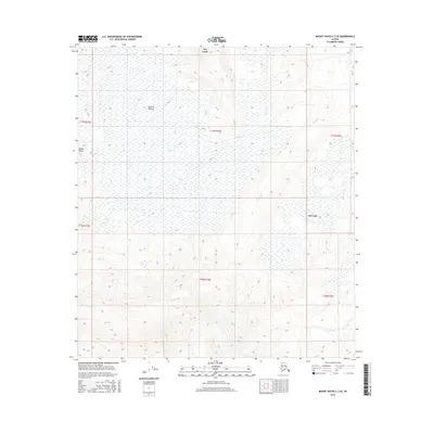
2016 Map of Mount Hayes C-2 SE
USGS Topo · Published 2016About this map
Macomb Plateau dominates the upper reaches of this interior Alaska terrain, providing a high-elevation view of the drainage patterns within the eastern Alaska Range. The landscape is defined by its seasonal and perennial water systems, including the branching networks of Dry Creek and Berry Cr. Near the eastern edge of the survey, the presence of Dot Lake serves as a primary geographic anchor. The map illustrates a complex topographical transition where high-plateau surfaces give way to the deeply etched valleys of Prospect Cr and Bear Creek. This 2016 survey documents the untouched hydrology and landform elevations prior to modern shifts in the regional climate, recording the precise contours of the Unorganized Borough's wilderness.
Find a feature on this map
14 named features on this map. Tap any name to fly to it.
Don’t see what you’re looking for? This feature index may not catch every label — zoom into the map to look around manually.
Map Details
Editions of this 2016 Mount Hayes C-2 SE Map
This is the sole edition of this map. No revisions or reprints were ever made.
Other maps of this area

1950 · Mount Hayes
USGS Topo · 1:250,000

1951 · Mount Hayes
USGS Topo · 1:250,000

1954 · Mount Hayes B-1
USGS Topo · 1:63,360

1954 · Mount Hayes C-1
USGS Topo · 1:63,360

1955 · Mount Hayes C-2
USGS Topo · 1:63,360

1955 · Mount Hayes B-2
USGS Topo · 1:63,360

1955 · Mount Hayes C-1
USGS Topo · 1:63,360
1955 · Mount Hayes B-1
USGS Topo · 1:63,360

1955 · Mount Hayes
USGS Topo · 1:250,000
2016 · Mount Hayes B-2 NW
USGS Topo · 1:25,000