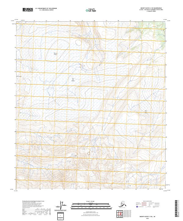
2024 Map of Mount Hayes C-2 SE
USGS Topo · Published 2024About this map
Macomb Plateau dominates the northern reaches of this landscape within the Alaska Range, situated in the Southeast Fairbanks Census Area. This contemporary topographic record captures the complex drainage systems that define the high-altitude terrain, where water features like Dry Creek and Berry Creek descend toward lower elevations. The southern portion of the quadrangle is marked by the headwaters of Prospect Creek and Bear Creek, illustrating the intricate natural irrigation of the subarctic wilderness.
Find a feature on this map
13 named features on this map. Tap any name to fly to it.
Don’t see what you’re looking for? This feature index may not catch every label — zoom into the map to look around manually.
Map Details
Editions of this 2024 Mount Hayes C-2 SE Map
This is the sole edition of this map. No revisions or reprints were ever made.
Other maps of this area

1950 · Mount Hayes
USGS Topo · 1:250,000

1951 · Mount Hayes
USGS Topo · 1:250,000

1954 · Mount Hayes B-1
USGS Topo · 1:63,360

1954 · Mount Hayes C-1
USGS Topo · 1:63,360

1955 · Mount Hayes C-2
USGS Topo · 1:63,360

1955 · Mount Hayes B-2
USGS Topo · 1:63,360

1955 · Mount Hayes C-1
USGS Topo · 1:63,360
1955 · Mount Hayes B-1
USGS Topo · 1:63,360

1955 · Mount Hayes
USGS Topo · 1:250,000
2016 · Mount Hayes B-2 NW
USGS Topo · 1:25,000