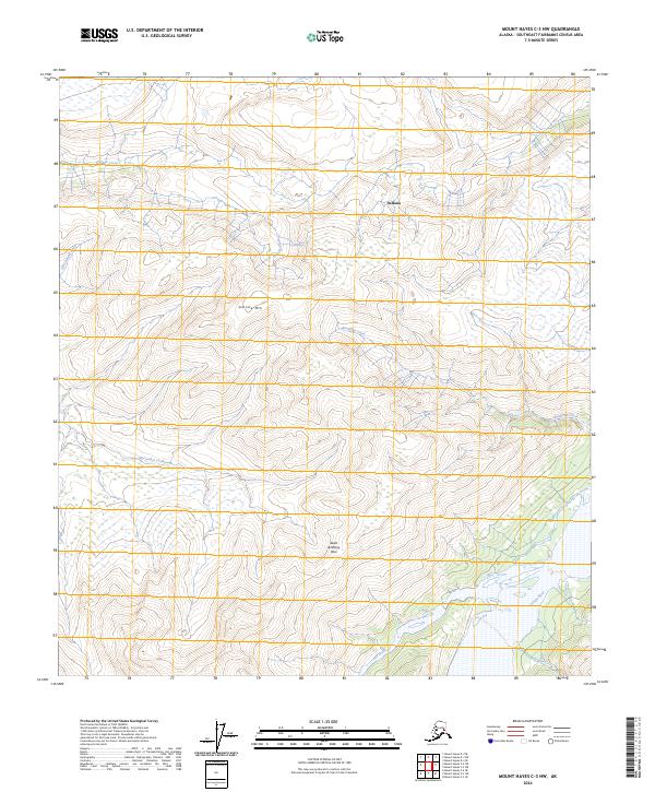
2024 Map of Mount Hayes C-3 NW
USGS Topo · Published 2024About this map
Saint Anthony Pass and the surrounding peaks dominate this interior Alaskan landscape, where the high-altitude terrain of Granite Mtn provides the headwaters for several prominent drainages. The Gerstle River flows through the southeastern quadrant, while Deltana marks a distinct topographic feature in the northern reaches. This 2024 survey captures a wilderness largely defined by its hydrological network, including the meandering paths of McCumber Creek and Granite Creek. The lack of road infrastructure underscores the area's isolation, with mapping focused on the precise placement of natural landmarks and seasonal watercourses like July Creek and Old Channel Creek. This record is particularly valuable for those studying the drainage patterns and unchanged landforms of the Southeast Fairbanks Census Area.
Find a feature on this map
16 named features on this map. Tap any name to fly to it.
Don’t see what you’re looking for? This feature index may not catch every label — zoom into the map to look around manually.
Map Details
Editions of this 2024 Mount Hayes C-3 NW Map
This is the sole edition of this map. No revisions or reprints were ever made.
Other maps of this area

1950 · Mount Hayes
USGS Topo · 1:250,000

1950 · Mount Hayes D-4
USGS Topo · 1:63,360

1950 · Mount Hayes C-4
USGS Topo · 1:63,360

1951 · Mount Hayes
USGS Topo · 1:250,000

1952 · Mount Hayes D-4
USGS Topo · 1:63,360

1952 · Mount Hayes C-4
USGS Topo · 1:63,360

1954 · Mount Hayes C-3
USGS Topo · 1:63,360

1954 · Mount Hayes D-3
USGS Topo · 1:63,360
1955 · Mount Hayes D-3
USGS Topo · 1:63,360

1955 · Mount Hayes C-3
USGS Topo · 1:63,360