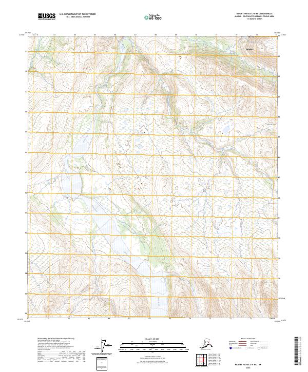
2024 Map of Mount Hayes C-4 NE
USGS Topo · Published 2024About this map
Deltana sits in the northeast corner of this Interior Alaska landscape, where the alluvial patterns of Jarvis Creek and McCumber Creek dominate the drainage system. The terrain is characterized by a complex network of braided waterways and wetlands, reflecting the seasonal shifts of glacial runoff. Granite Mtn rises to the east, providing a stark topographical contrast to the low-lying basins of Old Channel Creek and Morningstar Creek. The map illustrates the intricate land divisions across numerous Townships and Ranges, including t14s r11e, which encompass a wilderness defined by water. This survey offers a precise look at the hydrography of the region, from the narrow path of Little Gold Creek to the broader reaches of Riley Creek, documenting the shifting channels and tributaries that shape the Southeast Fairbanks Census Area.
Find a feature on this map
21 named features on this map. Tap any name to fly to it.
Don’t see what you’re looking for? This feature index may not catch every label — zoom into the map to look around manually.
Map Details
Editions of this 2024 Mount Hayes C-4 NE Map
This is the sole edition of this map. No revisions or reprints were ever made.
Other maps of this area

1950 · Mount Hayes
USGS Topo · 1:250,000

1950 · Mount Hayes D-4
USGS Topo · 1:63,360

1950 · Mount Hayes C-4
USGS Topo · 1:63,360

1951 · Mount Hayes
USGS Topo · 1:250,000

1952 · Mount Hayes D-4
USGS Topo · 1:63,360

1952 · Mount Hayes C-4
USGS Topo · 1:63,360

1954 · Mount Hayes C-3
USGS Topo · 1:63,360

1954 · Mount Hayes D-3
USGS Topo · 1:63,360
1955 · Mount Hayes D-3
USGS Topo · 1:63,360

1955 · Mount Hayes C-3
USGS Topo · 1:63,360