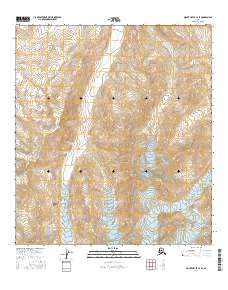
2016 Map of Mount Hayes C-4 SE
USGS Topo · Published 2016About this map
The Alaska Range dominates this portion of Southeast Fairbanks, where glacial activity and mountain hydrology define the landscape. Higher elevations in the southern half of the quadrangle contain the Riley Cr Glacier, which feeds the northern-flowing Riley Creek. The map documents a complex drainage network including Jarvis Creek and numerous smaller tributaries like Little Gold Cr and Morningstar Cr. This 2016 survey illustrates the high-altitude terrain of the interior, showing the transition from glacial ice to the carved valleys of Gunnysack Cr and Ruby Cr. The lack of man-made infrastructure or named settlements emphasizes the character of this undeveloped wilderness, focusing purely on the physical geography of the range.
Find a feature on this map
18 named features on this map. Tap any name to fly to it.
Don’t see what you’re looking for? This feature index may not catch every label — zoom into the map to look around manually.
Map Details
Editions of this 2016 Mount Hayes C-4 SE Map
This is the sole edition of this map. No revisions or reprints were ever made.
Other maps of this area

1950 · Mount Hayes
USGS Topo · 1:250,000

1950 · Mount Hayes C-4
USGS Topo · 1:63,360

1951 · Mount Hayes
USGS Topo · 1:250,000

1952 · Mount Hayes C-4
USGS Topo · 1:63,360

1952 · Mount Hayes B-4
USGS Topo · 1:63,360

1954 · Mount Hayes C-3
USGS Topo · 1:63,360

1954 · Mount Hayes B-4
USGS Topo · 1:63,360

1955 · Mount Hayes B-3
USGS Topo · 1:63,360

1955 · Mount Hayes C-3
USGS Topo · 1:63,360

1955 · Mount Hayes
USGS Topo · 1:250,000