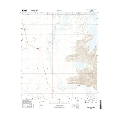
2016 Map of Mount Hayes D-2 NW
USGS Topo · Published 2016About this map
The Tanana River weaves through this interior Alaskan landscape, defining the transition between low-lying marshlands and rising upland terrain. To the east, the waters of Healy Lake and Moose Lake are prominent features near the edge of more substantial elevation changes, while the Gerstle River flows through the southwestern reaches. While much of the area remains dominated by complex hydrography and wetlands, human access is marked by the presence of Cummings Street and Mill Road. This 2016 survey provides a precise look at the township and range lines, including t11s r15e, which organize the remote territory of the Unorganized Borough. The map's detailed contouring reveals the steep relief adjacent to the river valley, offering insight into the geographical constraints that have shaped local travel and land use over the decades.
Find a feature on this map
11 named features on this map. Tap any name to fly to it.
Don’t see what you’re looking for? This feature index may not catch every label — zoom into the map to look around manually.
Map Details
Editions of this 2016 Mount Hayes D-2 NW Map
This is the sole edition of this map. No revisions or reprints were ever made.
Other maps of this area

1950 · Mount Hayes
USGS Topo · 1:250,000

1950 · Big Delta
USGS Topo · 1:250,000

1951 · Big Delta
USGS Topo · 1:250,000

1951 · Mount Hayes
USGS Topo · 1:250,000

1954 · Mount Hayes D-2
USGS Topo · 1:63,360

1954 · Mount Hayes D-3
USGS Topo · 1:63,360

1954 · Big Delta A-2
USGS Topo · 1:63,360

1955 · Big Delta A-3
USGS Topo · 1:63,360

1955 · Big Delta A-2
USGS Topo · 1:63,360

1955 · Mount Hayes D-2
USGS Topo · 1:63,360