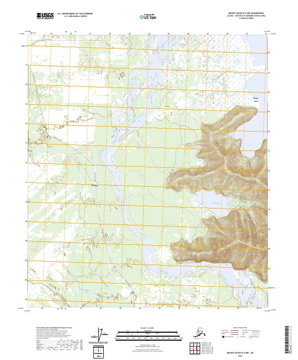
2024 Map of Mount Hayes D-2 NW
USGS Topo · Published 2024About this map
The Tanana River dominates this interior landscape, carving a wide path where braided channels meet the wetlands south of Healy Lake. The settlement of Deltana serves as the primary human landmark in this region, situated west of the river's main course. The topography is defined by the sharp contrast between the low-lying river plains and the rising elevations surrounding Moose Lake to the east. Transportation in this rural Alaskan corridor is anchored by Cummings Street, which traces the western side of the river valley, while Mill Road provides access to the northern marshlands. The intersection of the Gerstle River with the Tanana River system highlights the complex hydrology of the Southeast Fairbanks area, where seasonal water flow and glacial silt have historically shaped the accessibility of the backcountry for local residents and land users.
Find a feature on this map
13 named features on this map. Tap any name to fly to it.
Don’t see what you’re looking for? This feature index may not catch every label — zoom into the map to look around manually.
Map Details
Editions of this 2024 Mount Hayes D-2 NW Map
This is the sole edition of this map. No revisions or reprints were ever made.
Other maps of this area

1950 · Mount Hayes
USGS Topo · 1:250,000

1950 · Big Delta
USGS Topo · 1:250,000

1951 · Big Delta
USGS Topo · 1:250,000

1951 · Mount Hayes
USGS Topo · 1:250,000

1954 · Mount Hayes D-2
USGS Topo · 1:63,360

1954 · Mount Hayes D-3
USGS Topo · 1:63,360

1954 · Big Delta A-2
USGS Topo · 1:63,360

1955 · Big Delta A-3
USGS Topo · 1:63,360

1955 · Big Delta A-2
USGS Topo · 1:63,360

1955 · Mount Hayes D-2
USGS Topo · 1:63,360