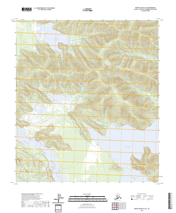
2024 Map of Mount Hayes D-2 SE
USGS Topo · Published 2024About this map
Tanana River flows through the southwestern corner of this topographic study, serving as a primary hydrological artery for the Southeast Fairbanks Census Area. The landscape is dominated by significant freshwater bodies, including the expansive Twelvemile Lake in the north and the broad reaches of Lake George in the southeast. The interior terrain is defined by the drainage patterns of George Creek, which links several smaller water features across the central valley floor. In the southwest, the Alaska Highway cuts across the river flats, providing the only major vehicular transit corridor through this wilderness. This corridor demonstrates the essential relationship between high-elevation lake basins and the lowland river systems that define the geography of the Alaska Interior.
Find a feature on this map
13 named features on this map. Tap any name to fly to it.
Don’t see what you’re looking for? This feature index may not catch every label — zoom into the map to look around manually.
Map Details
Editions of this 2024 Mount Hayes D-2 SE Map
This is the sole edition of this map. No revisions or reprints were ever made.
Other maps of this area

1950 · Mount Hayes
USGS Topo · 1:250,000

1951 · Mount Hayes
USGS Topo · 1:250,000

1954 · Mount Hayes D-2
USGS Topo · 1:63,360

1954 · Mount Hayes D-1
USGS Topo · 1:63,360

1954 · Mount Hayes C-1
USGS Topo · 1:63,360

1955 · Mount Hayes C-2
USGS Topo · 1:63,360

1955 · Mount Hayes C-1
USGS Topo · 1:63,360

1955 · Mount Hayes D-2
USGS Topo · 1:63,360

1955 · Mount Hayes
USGS Topo · 1:250,000
2016 · Mount Hayes D-2 NE
USGS Topo · 1:25,000