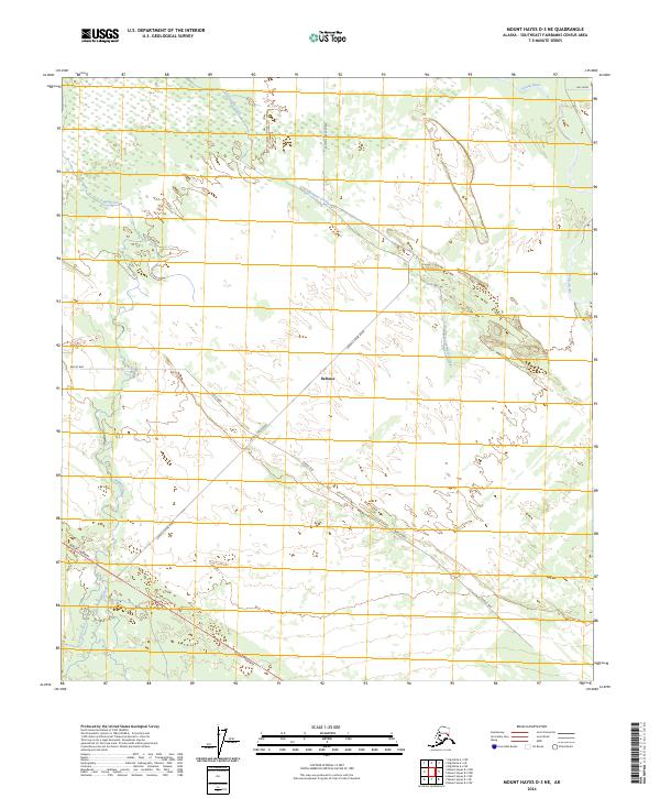
2024 Map of Mount Hayes D-3 NE
USGS Topo · Published 2024About this map
Deltana sits at the center of this landscape where agricultural infrastructure meets glacial water systems. The map illustrates a structured network of modern local roads, including Barley Way and Sawmill Creek Road, which cut diagonally across the terrain to connect with the primary corridor of the Alaska Highway in the southwest corner. The drainage patterns are defined by the braided path of the Gerstle River to the east and the winding courses of Clearwater Creek and Sawmill Creek. These water bodies and the straight-line township boundaries of t11s r13e and t11s r14e reveal how the land in the Southeast Fairbanks area has been organized for contemporary transit and local industry.
Find a feature on this map
15 named features on this map. Tap any name to fly to it.
Don’t see what you’re looking for? This feature index may not catch every label — zoom into the map to look around manually.
Map Details
Editions of this 2024 Mount Hayes D-3 NE Map
This is the sole edition of this map. No revisions or reprints were ever made.
Other maps of this area

1950 · Mount Hayes
USGS Topo · 1:250,000

1950 · Big Delta
USGS Topo · 1:250,000

1951 · Big Delta
USGS Topo · 1:250,000

1951 · Mount Hayes
USGS Topo · 1:250,000

1954 · Mount Hayes D-2
USGS Topo · 1:63,360

1954 · Mount Hayes D-3
USGS Topo · 1:63,360

1954 · Big Delta A-2
USGS Topo · 1:63,360

1955 · Big Delta A-3
USGS Topo · 1:63,360

1955 · Big Delta A-2
USGS Topo · 1:63,360

1955 · Mount Hayes D-2
USGS Topo · 1:63,360