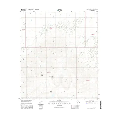
2016 Map of Mount Hayes D-3 SW
USGS Topo · Published 2016About this map
The Alaska Range dominates this interior terrain, where high-altitude geography is defined by a series of prominent peaks and glacial valleys. Central to this survey are the Granite Mountains, featuring notable landmarks such as Granite Mtn and Shovel Point Horn. The drainage network is composed of numerous creeks, including Rhoads Cr and Hajdukovich Cr, which carve through the sediment-rich Till Valley and the expansive Portalus Valley.
Find a feature on this map
21 named features on this map. Tap any name to fly to it.
Don’t see what you’re looking for? This feature index may not catch every label — zoom into the map to look around manually.
Map Details
Editions of this 2016 Mount Hayes D-3 SW Map
This is the sole edition of this map. No revisions or reprints were ever made.
Other maps of this area

1950 · Mount Hayes
USGS Topo · 1:250,000

1950 · Mount Hayes D-4
USGS Topo · 1:63,360

1950 · Mount Hayes C-4
USGS Topo · 1:63,360

1951 · Mount Hayes
USGS Topo · 1:250,000

1952 · Mount Hayes D-4
USGS Topo · 1:63,360

1952 · Mount Hayes C-4
USGS Topo · 1:63,360

1954 · Mount Hayes C-3
USGS Topo · 1:63,360

1954 · Mount Hayes D-3
USGS Topo · 1:63,360
1955 · Mount Hayes D-3
USGS Topo · 1:63,360

1955 · Mount Hayes C-3
USGS Topo · 1:63,360