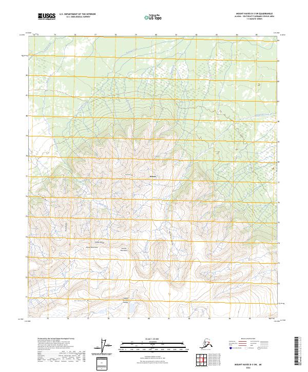
2024 Map of Mount Hayes D-3 SW
USGS Topo · Published 2024About this map
Alaska Range peaks dominate this section of the Southeast Fairbanks Census Area, revealing a high-altitude landscape defined by glacially carved valleys and formidable massifs. The northern reaches of the quadrangle transition into the Deltana region, where numerous watercourses like Arrow Creek and Cockscomb Creek flow northward from the higher elevations. This area is a complex network of drainage basins, with Hajdukovich Creek and Rhoads Creek cutting through the mountainous terrain.
Find a feature on this map
23 named features on this map. Tap any name to fly to it.
Don’t see what you’re looking for? This feature index may not catch every label — zoom into the map to look around manually.
Map Details
Editions of this 2024 Mount Hayes D-3 SW Map
This is the sole edition of this map. No revisions or reprints were ever made.
Other maps of this area

1950 · Mount Hayes
USGS Topo · 1:250,000

1950 · Mount Hayes D-4
USGS Topo · 1:63,360

1950 · Mount Hayes C-4
USGS Topo · 1:63,360

1951 · Mount Hayes
USGS Topo · 1:250,000

1952 · Mount Hayes D-4
USGS Topo · 1:63,360

1952 · Mount Hayes C-4
USGS Topo · 1:63,360

1954 · Mount Hayes C-3
USGS Topo · 1:63,360

1954 · Mount Hayes D-3
USGS Topo · 1:63,360
1955 · Mount Hayes D-3
USGS Topo · 1:63,360

1955 · Mount Hayes C-3
USGS Topo · 1:63,360