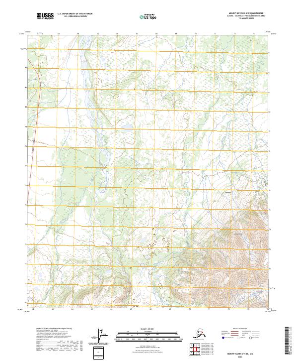
2024 Map of Mount Hayes D-4 SE
USGS Topo · Published 2024About this map
Jarvis Creek dominates the lowlands of this Interior Alaska landscape, its wide, braided channel flowing north toward the Tanana valley. To the west, the Richardson Highway provides the primary transit corridor, skirting the edge of the wetlands and forests. The settlement of Deltana serves as the local hub in this area of transition, where the relatively flat drainage basins begin to rise sharply into the southern highlands.
Find a feature on this map
14 named features on this map. Tap any name to fly to it.
Don’t see what you’re looking for? This feature index may not catch every label — zoom into the map to look around manually.
Map Details
Editions of this 2024 Mount Hayes D-4 SE Map
This is the sole edition of this map. No revisions or reprints were ever made.
Other maps of this area

1950 · Mount Hayes
USGS Topo · 1:250,000

1950 · Mount Hayes D-4
USGS Topo · 1:63,360

1950 · Mount Hayes C-4
USGS Topo · 1:63,360

1951 · Mount Hayes
USGS Topo · 1:250,000

1952 · Mount Hayes D-4
USGS Topo · 1:63,360

1952 · Mount Hayes C-4
USGS Topo · 1:63,360

1954 · Mount Hayes C-3
USGS Topo · 1:63,360

1954 · Mount Hayes D-3
USGS Topo · 1:63,360
1955 · Mount Hayes D-3
USGS Topo · 1:63,360

1955 · Mount Hayes C-3
USGS Topo · 1:63,360