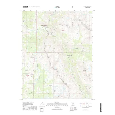
2018 Map of Mount Henry
USGS Topo · Published 2018About this map
Mt Henry stands as a prominent centerpiece in this high-altitude landscape where the Sierra National Forest meets Kings Canyon National Park. The topography is defined by massive granite features including Pavilion Dome and Emerald Peak, separated by the deep glacial carving of Goddard Canyon and Evolution Valley. A significant segment of the Pacific Crest National Scenic Trail winds through the eastern half of the map, passing by landmarks like John Muir Rock and through the sweeping Evolution Meadow.
Find a feature on this map
58 named features on this map. Tap any name to fly to it.
Don’t see what you’re looking for? This feature index may not catch every label — zoom into the map to look around manually.
Map Details
Editions of this 2018 Mount Henry Map
This is the sole edition of this map. No revisions or reprints were ever made.
Other maps of this area

1912 · Mt. Goddard
USGS Topo · 1:125,000

1947 · Mariposa
USGS Topo · 1:250,000

1948 · Mariposa
USGS Topo · 1:250,000

1948 · Mt. Goddard
USGS Topo · 1:62,500

1949 · Mt. Tom
USGS Topo · 1:62,500

1951 · Mt. Tom
USGS Topo · 1:62,500

1951 · Mt. Goddard
USGS Topo · 1:62,500

1952 · Mt. Goddard
USGS Topo · 1:62,500

1953 · Mt Abbot
USGS Topo · 1:62,500

1953 · Blackcap Mtn
USGS Topo · 1:62,500