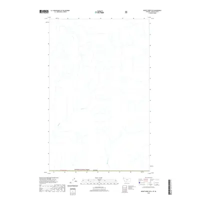
2020 Map of Mount Henry OE N
USGS Topo · Published 2020About this map
The international boundary of Canada defines the northern extent of this remote landscape, where the drainage systems of the Kootenai National Forest flow through the backcountry. This 2020 survey documents a largely undeveloped stretch of the Lincoln County and British Columbia borderlands. The terrain is characterized by the winding headwaters of Ward Cr and Blacktail Cr, showing the primary watercourses that shape this high-elevation forest environment. Because the map covers the intersection of federal forest lands and the international border, it provides a precise look at the township and range lines, including T 37 N R 31 W, which govern the administrative and topographic layout of this section of the Kootenai.
Find a feature on this map
5 named features on this map. Tap any name to fly to it.
Don’t see what you’re looking for? This feature index may not catch every label — zoom into the map to look around manually.
Map Details
Editions of this 2020 Mount Henry OE N Map
This is the sole edition of this map. No revisions or reprints were ever made.
Other maps of this area

1957 · Kalispell
USGS Topo · 1:250,000

1960 · Kalispell
USGS Topo · 1:250,000

1961 · Kalispell
USGS Topo · 1:250,000

1963 · Robinson Mountain
USGS Topo · 1:24,000

1963 · Bonnet Top
USGS Topo · 1:24,000

1963 · Mount Henry
USGS Topo · 1:24,000

1979 · Yaak River
USGS Topo · 1:100,000
1997 · Robinson Mountain
USGS Topo · 1:24,000
1997 · Mount Henry
USGS Topo · 1:24,000
1997 · Bonnet Top
USGS Topo · 1:24,000