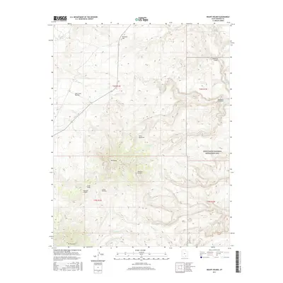
2017 Map of Mount Holmes
USGS Topo · Published 2017About this map
The Henry Mountains dominate this high-desert landscape in Garfield County, anchored by the prominent peaks of Mt Holmes and Mt Ellsworth. This region, part of the Little Rockies range, shows a complex network of drainage systems including Milk Cr, Swett Cr, and the various forks of Ticaboo Cr. The southeastern portion of the map transitions into the Glen Canyon National Recreation Area, where the topography descends toward the Colorado River basin.
Find a feature on this map
27 named features on this map. Tap any name to fly to it.
Don’t see what you’re looking for? This feature index may not catch every label — zoom into the map to look around manually.
Map Details
Editions of this 2017 Mount Holmes Map
This is the sole edition of this map. No revisions or reprints were ever made.
Other maps of this area

1886 · Henry Mountains
USGS Topo · 1:250,000

1892 · Henry Mountains
USGS Topo · 1:250,000

1952 · Mt Pennell 1 SW
USGS Topo · 1:24,000

1952 · Mancos Mesa
USGS Topo · 1:62,500

1952 · Mt Pennell 1 NE
USGS Topo · 1:24,000

1952 · Mt Hillers
USGS Topo · 1:62,500

1952 · Mt Pennell 1 SE
USGS Topo · 1:24,000

1952 · Mt Pennell 1 NW
USGS Topo · 1:24,000

1952 · Hite
USGS Topo · 1:62,500

1953 · Mt Pennell 4 NE
USGS Topo · 1:24,000