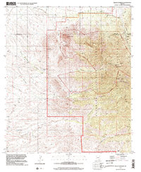
1996 Map of Mount Hopkins
USGS Topo · Published 2002About this map
Elephant Head and Yoas Mountain dominate the western horizon of this high-altitude landscape, where the Santa Rita Mountains rise sharply above the desert floor. The map highlights a significant scientific presence at the summit of Mount Hopkins, marked by the Smithsonian Astrophysical Observatory. This peak, along with the nearby Mount Wrightson within the Mount Wrightson Wilderness, forms a topographic barrier that funnels drainage into complex systems like Agua Caliente Canyon and Madera Canyon.
Find a feature on this map
46 named features on this map. Tap any name to fly to it.
Don’t see what you’re looking for? This feature index may not catch every label — zoom into the map to look around manually.
Map Details
Editions of this 1996 Mount Hopkins Map
This is the sole edition of this map. No revisions or reprints were ever made.
Other maps of this area

1904 · Patagonia
USGS Topo · 1:125,000

1905 · Patagonia
USGS Topo · 1:125,000

1920 · Arivaca
USGS Topo · 1:125,000

1922 · Agus Caliente
USGS Topo · 1:62,500

1925 · Samaniego Peak
USGS Topo · 1:62,500

1926 · Helvetia
USGS Topo · 1:62,500

1939 · Twin Buttes
USGS Topo · 1:62,500

1939 · Tubac
USGS Topo · 1:62,500

1941 · Twin Buttes
USGS Topo · 1:62,500

1943 · Tubac
USGS Topo · 1:62,500