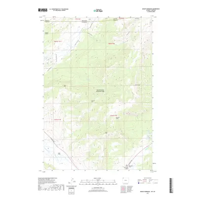
2017 Map of Mount Hornaday
USGS Topo · Published 2017About this map
Yellowstone National Park dominates this high-country landscape, where the Lamar River winds through the broad Lamar Valley in the southern portion of the quadrangle. This 2017 survey details a wilderness network of waterways and high peaks, including the prominent Druid Peak and the namesake Mt Hornaday along the Absaroka Range. The map documents critical backcountry infrastructure, from the Slough Creek Trail and Bliss Pass Trail to the 2S1 Campsite Spur Trail, providing a modern record of recreational access points.
Find a feature on this map
36 named features on this map. Tap any name to fly to it.
Don’t see what you’re looking for? This feature index may not catch every label — zoom into the map to look around manually.
Map Details
Editions of this 2017 Mount Hornaday Map
This is the sole edition of this map. No revisions or reprints were ever made.
Other maps of this area

1886 · Canyon
USGS Topo · 1:125,000

1891 · Livingston
USGS Topo · 1:250,000

1893 · Livingston
USGS Topo · 1:250,000

1895 · Canyon
USGS Topo · 1:125,000

1896 · Canyon
USGS Topo · 1:125,000

1901 · Canyon
USGS Topo · 1:125,000

1907 · Canyon
USGS Topo · 1:125,000

1911 · Canyon
USGS Topo · 1:125,000

1940 · Mt Wallace
USGS Topo · 1:62,500

1942 · Cutoff Mtn
USGS Topo · 1:62,500