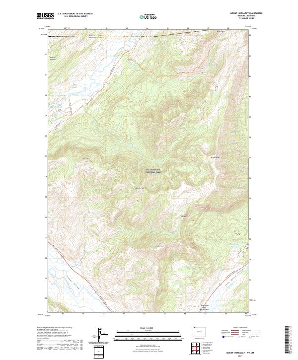
2021 Map of Mount Hornaday
USGS Topo · Published 2021About this map
Yellowstone National Park dominates this terrain where the high Buffalo Plateau meets the Absaroka Range. The landscape is defined by the deep carving of the Lamar River and Soda Butte Cr, creating the prominent Lamar Valley and Soda Butte Canyon. A unique geothermal landmark, the Soda Butte Crater, sits near the southern edge of the map, illustrating the area's volcanic heritage. Historically used trails like the Slough Creek Trl and Bliss Pass Trl wind through the mountains, connecting high-elevation water bodies such as McBride Lake, Trout Lake, and Shrimp Lake. Peaks like Mt Hornaday and Druid Peak provide significant relief, marking the wild boundary where the Wyoming and Montana state lines intersect at the northern margin.
Find a feature on this map
32 named features on this map. Tap any name to fly to it.
Don’t see what you’re looking for? This feature index may not catch every label — zoom into the map to look around manually.
Map Details
Editions of this 2021 Mount Hornaday Map
This is the sole edition of this map. No revisions or reprints were ever made.
Other maps of this area

1886 · Canyon
USGS Topo · 1:125,000

1891 · Livingston
USGS Topo · 1:250,000

1893 · Livingston
USGS Topo · 1:250,000

1895 · Canyon
USGS Topo · 1:125,000

1896 · Canyon
USGS Topo · 1:125,000

1901 · Canyon
USGS Topo · 1:125,000

1907 · Canyon
USGS Topo · 1:125,000

1911 · Canyon
USGS Topo · 1:125,000

1940 · Mt Wallace
USGS Topo · 1:62,500

1942 · Cutoff Mtn
USGS Topo · 1:62,500