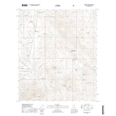
2018 Map of Mount Hughes
USGS Topo · Published 2018About this map
Patagonia sits at the southwestern edge of this high-desert landscape, where the town grid meets the riparian corridor of Sonoita Cr. This modern survey illustrates a rugged intersection of drainage systems and mountain peaks within the Coronado National Forest, notably defined by the Arizona National Scenic Trail as it winds through the southern foothills. The map reveals a dense network of canyons, including Redrock Canyon, Stevens Canyon, and CCC Canyon, which underscore the complex hydrology of the San Pedro River watershed. High points such as Mt Hughes, Kunde Mtn, and Ashburn Mtn provide significant relief, while numerous named water sources like Bible Spring and Kennedy Spring emphasize the critical nature of water management in the Santa Cruz County backcountry. This sheet is particularly useful for tracking the access roads and trails that penetrate the mountainous terrain north and east of the Patagonia settlement.
Find a feature on this map
70 named features on this map. Tap any name to fly to it.
Don’t see what you’re looking for? This feature index may not catch every label — zoom into the map to look around manually.
Map Details
Editions of this 2018 Mount Hughes Map
This is the sole edition of this map. No revisions or reprints were ever made.
Other maps of this area

1904 · Patagonia
USGS Topo · 1:125,000

1905 · Patagonia
USGS Topo · 1:125,000

1905 · Nogales
USGS Topo · 1:125,000

1922 · Agus Caliente
USGS Topo · 1:62,500

1932 · Lochiel
USGS Topo · 1:62,500

1932 · Elgin
USGS Topo · 1:62,500

1933 · Calabasas
USGS Topo · 1:62,500

1940 · Elgin
USGS Topo · 1:62,500

1947 · Elgin
USGS Topo · 1:62,500

1948 · Canelo Pass
USGS Topo · 1:24,000