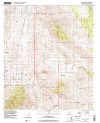
1996 Map of Mount Hughes
USGS Topo · Published 2002About this map
Patagonia serves as the primary hub of this landscape, situated along Sonoita Creek at the edge of the Coronado National Forest. The map documents a territory defined by historic mining and ranching interests, featuring the Santa Cruz Mine, Sansimon Mine, and the Aztec Group Mines near Aztec Gulch. Historical geography is particularly evident at Crittenden (Site), where a former rail-side settlement is marked near a small Cem.
Find a feature on this map
68 named features on this map. Tap any name to fly to it.
Don’t see what you’re looking for? This feature index may not catch every label — zoom into the map to look around manually.
Map Details
Editions of this 1996 Mount Hughes Map
2 editions found
Other maps of this area

1904 · Patagonia
USGS Topo · 1:125,000

1905 · Patagonia
USGS Topo · 1:125,000

1905 · Nogales
USGS Topo · 1:125,000

1922 · Agus Caliente
USGS Topo · 1:62,500

1932 · Lochiel
USGS Topo · 1:62,500

1932 · Elgin
USGS Topo · 1:62,500

1933 · Calabasas
USGS Topo · 1:62,500

1940 · Elgin
USGS Topo · 1:62,500

1947 · Elgin
USGS Topo · 1:62,500

1948 · Canelo Pass
USGS Topo · 1:24,000