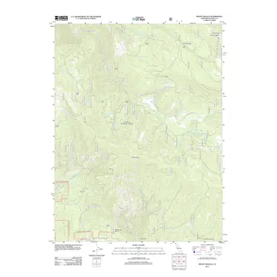
2012 Map of Mount Ingalls
USGS Topo · Published 2012About this map
Mount Ingalls and the high elevations of Grizzly Ridge anchor this 2012 survey of the northern Sierra Nevada, where the industrial legacy of the region is written into the hydrology. The presence of the Walker Mine Tailings Reservoir and the naming of Walker Mine Rd signal the historical footprint of copper mining in this corner of Plumas County. Below these industrial features, the landscape is defined by a dense network of watercourses including Little Grizzly Cr, Nye Cr, and Emigrant Cr.
Find a feature on this map
30 named features on this map. Tap any name to fly to it.
Don’t see what you’re looking for? This feature index may not catch every label — zoom into the map to look around manually.
Map Details
Editions of this 2012 Mount Ingalls Map
This is the sole edition of this map. No revisions or reprints were ever made.
Other maps of this area

1886 · Honey Lake
USGS Topo · 1:250,000

1891 · Downieville
USGS Topo · 1:125,000

1891 · Honey Lake
USGS Topo · 1:250,000

1893 · Honey Lake
USGS Topo · 1:250,000

1893 · Downieville
USGS Topo · 1:125,000

1895 · Downieville
USGS Topo · 1:125,000

1896 · Downieville
USGS Topo · 1:125,000

1897 · Downieville
USGS Topo · 1:125,000

1937 · Blairsden
USGS Topo · 1:48,000

1943 · Blairsden
USGS Topo · 1:62,500