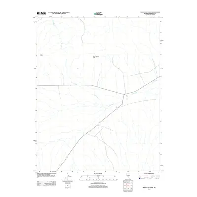
2012 Map of Mount Jackson
USGS Topo · Published 2012About this map
Mount Jackson stands as the dominant topographical feature in this high desert region of Esmeralda County, overlooking a network of ephemeral drainages and dry crossings. The landscape is defined by the prominent Mount Jackson Ridge, which bisects the quadrangle, and the extensive path of Jackson Wash as it trends through the basin. This 2012 survey illustrates the sparse but critical human infrastructure of the area, notably the Iron Corral, which suggests the enduring role of ranching and livestock management in this arid environment. The map details a minimal road network, including State Route 266, which serves as a primary transit corridor through the otherwise open terrain, connecting isolated landmarks across the valley floor.
Find a feature on this map
4 named features on this map. Tap any name to fly to it.
Don’t see what you’re looking for? This feature index may not catch every label — zoom into the map to look around manually.
Map Details
Editions of this 2012 Mount Jackson Map
This is the sole edition of this map. No revisions or reprints were ever made.
Other maps of this area

1908 · Lida
USGS Topo · 1:250,000

1913 · Lida
USGS Topo · 1:250,000

1945 · Goldfield
USGS Topo · 1:125,000

1952 · Goldfield
USGS Topo · 1:62,500

1954 · Goldfield
USGS Topo · 1:250,000

1955 · Goldfield
USGS Topo · 1:250,000

1958 · Goldfield
USGS Topo · 1:250,000

1962 · Goldfield
USGS Topo · 1:250,000

1968 · Lida
USGS Topo · 1:24,000

1968 · Stonewall Pass
USGS Topo · 1:24,000