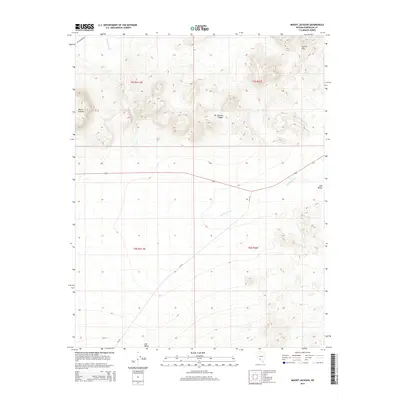
2014 Map of Mount Jackson
USGS Topo · Published 2014About this map
Mount Jackson and the neighboring Mt Jackson Ridge define the northern terrain of this Esmeralda County landscape, where desert topography meets the vast Lida Valley. This survey captures the region in 2014, showing a high-desert environment dominated by drainage systems like Jackson Wash, which cuts across the central and southern plains. The human footprint is sparse but specific, centered on transportation corridors such as 266, NV-774, and the unpaved Mt Jackson Rd leading into the heights. To the northeast, the Cuprite Hills rise from the valley floor, marking a geological transition typical of the Great Basin's basin-and-range structure. The map detail highlights the intersection of these dry washes and mountain foothills, providing a clear record of land use and access routes in this part of Nevada.
Find a feature on this map
12 named features on this map. Tap any name to fly to it.
Don’t see what you’re looking for? This feature index may not catch every label — zoom into the map to look around manually.
Map Details
Editions of this 2014 Mount Jackson Map
This is the sole edition of this map. No revisions or reprints were ever made.
Other maps of this area

1908 · Lida
USGS Topo · 1:250,000

1913 · Lida
USGS Topo · 1:250,000

1945 · Goldfield
USGS Topo · 1:125,000

1952 · Goldfield
USGS Topo · 1:62,500

1954 · Goldfield
USGS Topo · 1:250,000

1955 · Goldfield
USGS Topo · 1:250,000

1958 · Goldfield
USGS Topo · 1:250,000

1962 · Goldfield
USGS Topo · 1:250,000

1968 · Lida
USGS Topo · 1:24,000

1968 · Stonewall Pass
USGS Topo · 1:24,000