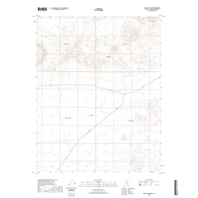
2018 Map of Mount Jackson
USGS Topo · Published 2018About this map
Mt Jackson Ridge dominates the northern landscape of this Esmeralda County quadrant, where the high desert terrain transitions into the broad expanse of Lida Valley. This 2018 survey by the U.S. Geological Survey provides a clear view of the arid hydrology of the region, anchored by the winding course of Jackson Wash as it moves through the valley floor. To the northeast, the Cuprite Hills rise sharply, marking a complex geological area known for its distinctive mineralized soils. The map documents the modern infrastructure of the Great Basin, showing the paths of Highway 266 and Route 71/774 as they navigate the basin-and-range topography. These transportation corridors follow the natural contours of the land, illustrating how human passage in this part of Nevada remains dictated by the significant vertical relief of the ridges and the open flats of the valley.
Find a feature on this map
10 named features on this map. Tap any name to fly to it.
Don’t see what you’re looking for? This feature index may not catch every label — zoom into the map to look around manually.
Map Details
Editions of this 2018 Mount Jackson Map
This is the sole edition of this map. No revisions or reprints were ever made.
Other maps of this area

1908 · Lida
USGS Topo · 1:250,000

1913 · Lida
USGS Topo · 1:250,000

1945 · Goldfield
USGS Topo · 1:125,000

1952 · Goldfield
USGS Topo · 1:62,500

1954 · Goldfield
USGS Topo · 1:250,000

1955 · Goldfield
USGS Topo · 1:250,000

1958 · Goldfield
USGS Topo · 1:250,000

1962 · Goldfield
USGS Topo · 1:250,000

1968 · Lida
USGS Topo · 1:24,000

1968 · Stonewall Pass
USGS Topo · 1:24,000